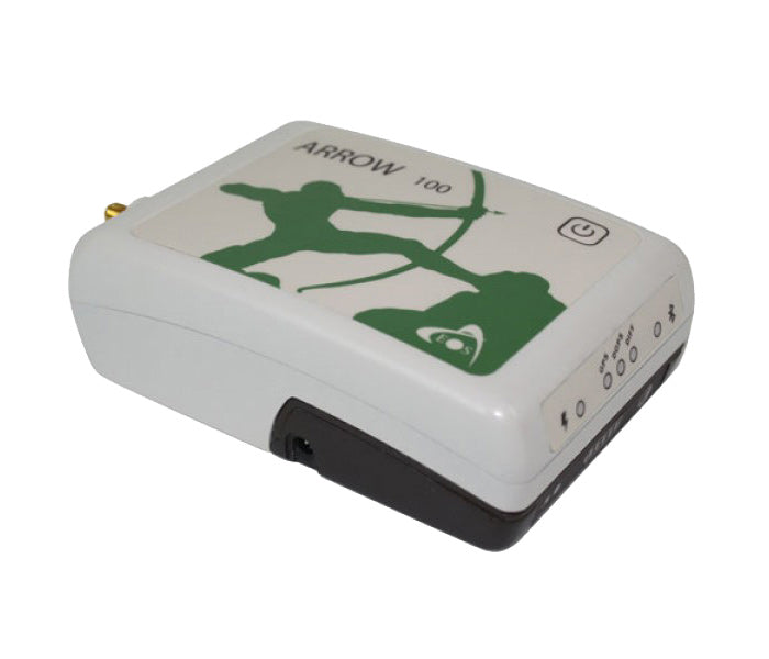
EOS Arrow 100 - DGNSS receiver
Shipping
1-3 days delivery


EOS Arrow 100 - DGNSS receiver
DGNSS receiver with high measurement accuracy for your Smartphone, Tablet or Notebook PC. Get measurement accuracy below the meter in your Android, Windows or iOS device in real time. With the Arrow 100, you are not tied to any specific hardware or GIS software
Work where other receivers don't work
Arrow 100 is developed especially for GIS users. You get better measurement accuracy from SBAS corrections than any other receiver on the market. It has a patented technology that allows it to be used under trees, around buildings and in rough terrain - When other receivers have no signal.
Arrow 100 receives satellite signals from both GPS and Glonass (possibly Galileo/BeiDou/QZSS) as well as SBAS corrections. In Europe, we get free SBAS corrections from EGNOS. Take advantage of real-time measurement and optimize your efficiency. No post-processing of the raw data is needed.
Explanation of different terms
GNSS = Global Navigation Satellite System. This term includes the following satellite systems from various countries and regions around the world.
- GPS = America
- GLONASS = Russia
- Galileo = European Satellite System (EU)
- BeiDou = China
- QZSS = Japan
GNSS satellite signals with corrections
If you want a measurement accuracy below 1-2 meters, you must choose a receiver that can receive corrections (corrections) from an SBAS system. A receiver that can do this is called DGNSS = Differential GNSS. The term DGPS is often used in these contexts.
If you receive signals from more satellite systems than American GPS and at the same time corrections from a free SBAS correction service such as EGNOS, the correct designation is DGNSS. In Europe we get free SBAS corrections from the EGNOS satellite. It is also possible to subscribe to a correction service. For example from Swepos, which is owned by Lantmäteriet.
- SBAS = Satellite-based augmentation systems
- DGNSS = Differential GNSS
- EGNOS = European Geostationary Navigation Overlay Service
Download data sheets and manuals
Here you can download data sheets and manuals for the EOS Arrow 100
Compatible map programs
With Arrow 100 you are not tied to any specific hardware or GIS software. The receiver works seamlessly with
- TerraGo Edge
- Esri Collector/ArcPad/ArcMobile
- Fulcrum AmigoCloud
- MapItFast
- GeoJot
- iCMTGIS
- and many more map programs.

Guide to new investment
Buying new measuring equipment is often a major investment for most companies.
We can therefore offer Financing or Leasing through our partner
Wasa Credit.
How does it work?
|
|
Select instrumentSelect the object you are interested in buying and request a quote from us. We offer financing for measuring equipment that costs from SEK 6,000 + VAT and upwards. |
|
|
Select financing schemeLeasing Rent |
